San Gil
a field guide for guests
A square with ceiba trees, a twin-towered cathedral, the Río Fonce running through town and, all around, canyons, waterfalls and stone villages. This is our guide to finding your feet: no invented walking minutes or bus times that change; that's what the front desk is for.
Directions to the hostel(opens in a new tab)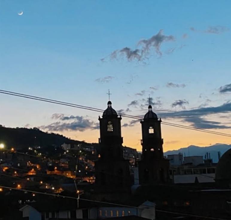
01 · In town
The centre, on foot from Carrera 8.
The hostel is one block from the main square; from there, much of the centre is walkable.
01
Parque La Libertad (main square)
San Gil's main square and meeting point, one block from the hostel: century-old ceibas, a lit fountain and a statue of Chief Guanentá, ringed by the town hall, cathedral, cafés and restaurants.
- A good spot for coffee in the shade of the ceibas
02
Santa Cruz Cathedral
On the corner of Carrera 9 and Calle 13, at the north-west end of Parque La Libertad. Begun in 1769, with early-20th-century towers; consecrated in 1935.
- It's a working church: be respectful during mass
03
El Gallineral Park
A park created in 1994 on an island between the Río Fonce and the Curití stream, on the malecón: gallinero trees, trails, plazas and a pool. The big-bottomed ant sculpture gazes at the river here.
- Check opening hours and entry at the front desk
04
Río Fonce malecón
The Fonce's riverside promenade, on San Gil's main river. El Gallineral is here, and rafting trips usually take out here.
- A nice late-afternoon stroll
Open in Google Maps(opens in a new tab)Rafting the Río Fonce
05
Market hall
San Gil's market, south-east of the historic centre, with hundreds of wholesale and retail stalls. It fills up at weekends, when locals do their shopping.
- Go hungry and bring cash
02 · Around San Gil
The map of plans.
An illustrated map, not to scale, using each town's or park's public coordinates. Tap a point to see the plan or open it in Google Maps.
Illustration, not to scale.
- The hostel, in central San Gil
- Towns and places with verified coordinates
- Rivers: approximate lines (we leave out the Suárez because we can't place it precisely)
Barichara
A stone-built colonial town whose historic centre was declared a National Monument in 1978. Start of the Camino Real to Guane.
BaricharaThe Camino Real from Barichara to GuaneOpen in Google Maps(opens in a new tab)
Guane
A village within Barichara, formerly Móncora and cradle of Guane culture, on a plateau overlooking the Suárez canyon. End of the Camino Real.
The Camino Real from Barichara to GuaneOpen in Google Maps(opens in a new tab)
Curití
A fique-weaving town with the Pescaderito river pools and caves such as Cueva de la Vaca and Cueva del Yeso.
Juan Curí waterfalls
Waterfalls on the San Gil–Charalá road at Hacienda Santa Rita, in Páramo municipality. Hiking, rappelling and canyoning with on-site operators.
Juan Curí waterfallsCanyoningRopes parkOpen in Google Maps(opens in a new tab)
Chicamocha Canyon
A semi-arid canyon carved by the Chicamocha River across Santander and into Boyacá, among the world's largest. Home to paragliding and wilder rafting.
Paragliding over the ChicamochaRafting the Río ChicamochaOpen in Google Maps(opens in a new tab)
Chicamocha National Park (Panachi)
A theme park in Aratoca on the Bucaramanga–San Gil road, opened in 1992, with canyon viewpoints and a cable car to Mesa de los Santos.
Paragliding over the ChicamochaOpen in Google Maps(opens in a new tab)
03 · Getting around
Buses, terminals and the Terminalito.
Nearby towns: head to the Terminalito. Long trips: the main bus terminal. Times and fares change: ask the front desk the day before.
Terminalito (local bus station)
Cootrasangil's regional terminal, with buses across Guanentá province: Barichara, Curití, Juan Curí and other nearby towns. It's close to the hostel.
- Ask the desk for times and the last bus back
San Gil bus terminal
The long-distance bus terminal, on the south-west edge of town on the road out to Bogotá. Companies such as Berlinas del Fonce, Copetran and Omega run from here.
04 · Responsible adventure
Enjoy Santander without scares.
Ask before paying
What's included, who guides, what safety gear they use and what happens if it rains. The desk helps you ask.
The weather decides
Paragliding and rivers depend on conditions. If an operator cancels or changes a plan, there's a reason.
Water, sun and shoes
Bring water, sunscreen and shoes that can get wet. The Santander sun is no joke.
Leave it as you found it
Stick to the trails, take your rubbish with you and respect the people in the villages.